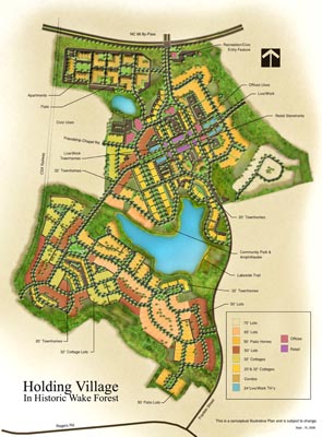
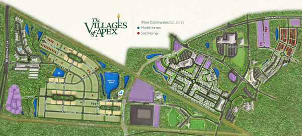
A site plan or site map is essential to give an overview of the scope of the development. In the past, these were created by architects, especially landscaping architects, and they were in markers, pen and ink, etc. Eventually, computer took over with vector graphics to allow very large print sizes. In addition to the usual usage, including website and prints, site plans had been used for table top with “Monopoly” houses to indicate lot statuses in the sales center. Of course, the problem was that not everyone can come to the sales center; even so, it unlikely provided real time lot status info. Well, here at Rendering House, we have the solution for our builders. In addition, we are always working on creating eye-catching content for our clients. Here are four examples:
1. Real Time Lot Status: This wonderful tool is part of our My Home App.
2. Points of Interests Map along with Neighborhood Context
3. Interactive map with an aerial view of your neighborhood.
4. Augmented Reality: This is the new and exciting of way see your neighborhood. You can place it on your table and see it from all angles!